Artificial Intelligence has already transformed how we analyze data, make decisions, and interact with technology. But in 2026, a new frontier is taking shape — GeoAI, the fusion of geospatial intelligence and AI. It’s redefining how enterprises visualize, predict, and respond to changes in the physical world. From mapping cities to managing supply chains and predicting disasters, GeoAI is becoming the invisible infrastructure behind smarter decisions.
What Is GeoAI?
GeoAI combines geospatial data (information tied to location) with AI models that can learn patterns, generate insights, and even create new spatial predictions. Think of it as AI with a map capable of understanding not just what’s happening, but where it’s happening.
In 2026, GeoAI is evolving beyond static maps. Generative AI models can now simulate traffic flows, predict retail demand by neighborhood, and visualize disaster impact zones before they occur. This shift from descriptive to predictive and generative intelligence is what makes GeoAI so powerful.
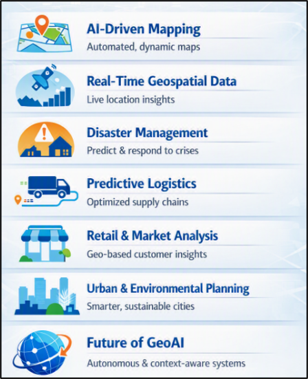
AI-Driven Mapping Tools
Traditional mapping relied on manual updates and satellite imagery. Today, AI-driven mapping tools automatically generate and update maps using real-time data from drones, sensors, and IoT devices.
Generative AI can fill in missing details like, reconstructing damaged roads after floods or predicting urban expansion patterns. These tools help governments plan infrastructure and businesses optimize delivery routes. For instance, a logistics company can use AI-generated maps to visualize traffic congestion and reroute vehicles dynamically, saving time and fuel. This ensures faster and accurate maps that evolve with real-world conditions.
Real-Time Geospatial Data
GeoAI thrives on real-time data streams — from satellites, mobile devices, and connected sensors. In 2026, enterprises use this data to monitor everything from crop health to retail foot traffic.
Generative AI models can synthesize these data layers to create predictive insights. For instance, retailers can forecast demand spikes in specific areas based on weather, events, or mobility patterns. A retail chain might use GeoAI to predict which stores will see higher footfall during a festival weekend and adjust inventory accordingly. This improves dynamic decision-making powered by location intelligence.
AI for Disaster Management
Disaster management is one of the most impactful applications of GeoAI. Generative AI can simulate disaster scenarios — floods, wildfires, earthquakes — and predict their spread based on terrain and weather data.
Emergency response teams use GeoAI dashboards to visualize risk zones, plan evacuation routes, and allocate resources efficiently. AI models can even generate synthetic satellite images to estimate damage before rescue teams arrive. During a cyclone, GeoAI can forecast flood levels across districts and suggest optimal shelter locations. This ensures faster response, better preparedness, and reduced loss of life.
Predictive Logistics Systems
Supply chains are inherently spatial — goods move across cities, countries, and continents. GeoAI enables predictive logistics, where AI models anticipate disruptions and optimize routes in real time.
Generative AI can simulate delivery scenarios, predict warehouse bottlenecks, and even generate alternative supply chain maps when routes are blocked. A global logistics firm can use GeoAI to forecast port delays and automatically reroute shipments through alternative hubs. This ensures resilient, adaptive logistics networks that minimize downtime.
Retail and Marketing Intelligence
Retailers are increasingly using GeoAI to understand where customers shop, how they move, and what influences their choices. Generative AI can create synthetic consumer heatmaps, forecast demand by region, and even simulate store layouts for better engagement.
In 2026, GeoAI helps brands decide where to open new stores, how to price products regionally, and how to personalize marketing based on local behavior. A supermarket chain can use GeoAI to identify underserved neighborhoods and predict the success of a new outlet before investing. This ensures smarter location-based business decisions.
Environmental and Urban Planning
Cities are living organisms that are constantly changing and expanding. GeoAI supports urban planners by generating predictive models of population growth, traffic density, and environmental impact.
Generative AI can simulate future cityscapes, helping planners visualize how new roads or buildings will affect air quality and mobility. A city council can use GeoAI to model how a new metro line will influence residential development and traffic flow. This ensures sustainable, data-driven urban development.
Future Scope of GeoAI
GeoAI is moving from niche applications to mainstream enterprise adoption. The convergence of Generative AI, IoT, and cloud computing is enabling real-time spatial intelligence at scale.
Here’s what the next wave looks like:
- Autonomous Decision Systems: AI agents that make location-based decisions without human intervention.
- Synthetic Geospatial Data: Generative models that create realistic spatial datasets for training and simulation.
- Cross-Domain Integration: GeoAI combining climate models, economic forecasts, and social data for holistic insights.
- Ethical GeoAI: Frameworks ensuring fairness, privacy, and transparency in location-based predictions.
GeoAI’s future lies in contextual intelligence — understanding not just where things are, but why they happen there.
For enterprises, GeoAI is more than a technology as it’s a strategic asset that enables:
- Operational Efficiency: Optimized routes, reduced waste, and faster decisions.
- Customer Insight: Location-aware personalization and demand forecasting.
- Risk Mitigation: Predictive alerts for supply chain or environmental disruptions.
GeoAI transforms spatial data into actionable intelligence that bridges the gap between the digital and physical worlds.
GeoAI in 2026 marks a turning point in how we perceive and use location intelligence. Generative AI is no longer just about creating text or images as it is about creating spatial understanding. From mapping and logistics to retail and disaster management, GeoAI is helping enterprises see the world not as static coordinates, but as dynamic systems that evolve in real time. As organizations embrace this technology, the winners will be those who combine AI innovation with ethical, transparent, and human-centered design.
Now that you have understood the nuances of Geo AI in 2026, you can take a deep dive into the concept and understand the practical implications of the same in the current industry. Get guidance from industry experts and thought leaders at Eduinx, a leading edtech institute in India. We offer both offline and virtual classroom learning experience that helps shape your career. With adequate assistance from our industry-led experts, you can land the right job at a good salary package. Learn more about our courses here.
Frequently Asked Questions (FAQs)
1. What is GeoAI?
- GeoAI is the fusion of the geospatial intelligence and AI, combining location-tied data with the AI models that can learn patterns, generate insights, and make spatial predictions.
- It's sort of AI plus a map — knowing not only what's going on but where it is going on, and more importantly, why it's going on there.
2. What sets GeoAI apart from the classic mapping technology?
- Traditional mapping was based on manual updates and satellite imagery taken at regular intervals.
- GeoAI goes beyond descriptive mapping to predictive and generative spatial intelligence with features such as simulating traffic patterns, forecasting retail demand by neighborhood, and visualizing before a disaster the impact zone of an event.
3. What do you think are uses of AI-driven mapping tools?
- Maps are automatically created and updated in real time from drone, sensor and IoT data, and can be completed automatically, such as after a flood, when parts of the road are destroyed.
- They help governments plan infrastructure.
- They optimize delivery routes for businesses.
- They redirect cars dynamically in response to traffic congestion to reduce travel time and fuel consumption.
4. What role does real-time geospatial data play in GeoAI?
- The GeoAI uses streams of satellite, mobile and connected sensor data for everything from crop health to retail foot traffic.
- The generative AI models combine these data layers to generate the predictions, like predicting an increase in demand in certain areas based on the weather, events or mobility.
5. What is the predictive logistics, and how does GeoAI power it?
- Goods move from city to city within a spatial network of countries and cities, and predictive logistics relies on the GeoAI to predict disruptions in the supply chain and optimise real-time delivery routing.
- Generative AI can simulate delivery scenarios, predict warehouse bottlenecks and map out alternative supply chains when routes are blocked, such as rerouting shipments if port delays are anticipated based on forecast.
6. Why is GeoAI considered a shift from descriptive to predictive intelligence?
- The older geospatial tools mostly described the current state of a location — where roads exist, where stores are located.
- In 2026 GeoAI goes beyond by creating forward‑looking predictions, such as simulating how cities grow or foretelling demand spikes before they occur.
- This makes the GeoAI a predictive and generative tool, it is not just a static reporting device.
7. Why is the GeoAI important for planning?
- Cities change all the time.
- GeoAI helps urban planners by building predictive models for population growth, traffic density and environmental impact.
- With GeoAI planners can test how a new road or metro line will change air quality, mobility and where people live before any construction starts.
- This leads to sustainable data‑driven choices.
8. Why does the GeoAI matter as an asset for enterprises not just a technical tool?
- GeoAI brings three business benefits.
- First it improves efficiency by optimizing routes and cutting waste.
- Second it gives customer insight through location‑based personalization and demand forecasting.
- Third it lowers risk with alerts for supply chain and environmental disruptions.
- These advantages make GeoAI a strategic asset, not a niche mapping tool.
9. What does generative AI do to make maps better, in 2026?
- The generative AI can add map details like the rebuilding damaged roads after a flood or predicting how the city areas will grow over time.
- This gives governments and businesses maps that change with real‑world conditions of depending on slow manual updates.
10. How does the GeoAI help during a disaster like a cyclone or a flood?
- During a cyclone, the GeoAI can predict flood levels in each of the districts and recommend the best shelter spots using terrain and real‑time weather data.
- This real‑time modeling lets emergency teams decide faster, boosting preparedness and possibly saving lives during the event.
11. How is the GeoAI expected to evolve beyond 2026?
- The next wave of GeoAI will bring new features:
- Autonomous decision systems: AI agents that make location‑based decisions without human help.
- Synthetic geospatial data: Generative models that create realistic spatial datasets, for training and simulation.
- Cross‑domain integration: Blending climate models economic forecasts and social data to give a complete picture.
- Ethical GeoAI frameworks: Making sure location‑based predictions are fair protect privacy and are transparent.
12. In the case of floods, cyclones, and other disasters, how can Geo AI be of assistance?
- GeoAI can assist emergency teams in identifying high-risk areas, in estimating the impact of a disaster, in optimising evacuation routes, and in prioritising emergency resources.
- During a cyclone or flood, a GeoAI system could combine terrain and elevation data, weather forecasts, rainfall information, river levels, satellite imagery, road networks, population density, and shelter locations.
- AI models could then identify the areas that might be affected and assist emergency teams in deciding on safer routes for evacuation, locations for shelters, and the priorities for allocating resources.
- Since there is uncertainty involved in disaster predictions, human experts and emergency authorities should still play a role in making important decisions.
13. Why is GeoAI becoming a strategic technology for businesses?
- GeoAI is able to generate tangible business value by enhancing operational efficiency, customer intelligence, forecasting, and risk management.
- Three major benefits are:
- Efficiency in operations: improve the routes for deliveries, the transportation networks, the field operations, and the use of the infrastructure.
- Understanding geographic demand, customer movement, store performance, and location-based behaviour.
- Risk management: Find possible supply-chain disruptions, environmental risks, infrastructure problems, and geographic weak spots.
- In organizations in which location has an effect on revenue, customers, assets, or operations, GeoAI can evolve into a strategic business capability rather than merely being a mapping technology.
14. What does the future of GeoAI look like after 2026?
- The next stage of GeoAI is going to involve the combination of autonomous AI agents, synthetic geospatial data, digital twins, multimodal AI, and real-time location intelligence.
- Important areas of development include:
- Autonomous geospatial agents are AI systems which can analyze geographic conditions and suggest actions.
- Synthetic geospatial data refers to spatial datasets which are artificially generated for use in simulations and for training artificial intelligence.
- Geospatial digital twins are virtual representations of cities, transportation networks, factories, and infrastructure.
- Multimodal GeoAI uses AI to bring together maps, satellite images, sensor data, text, weather, and video.
- Cross-domain intelligence means bringing together climate, economic, mobility, demographic, and infrastructure data.
- GeoAI that is responsible should have stronger standards in the areas of privacy, transparency, bias, security, and explainability.